
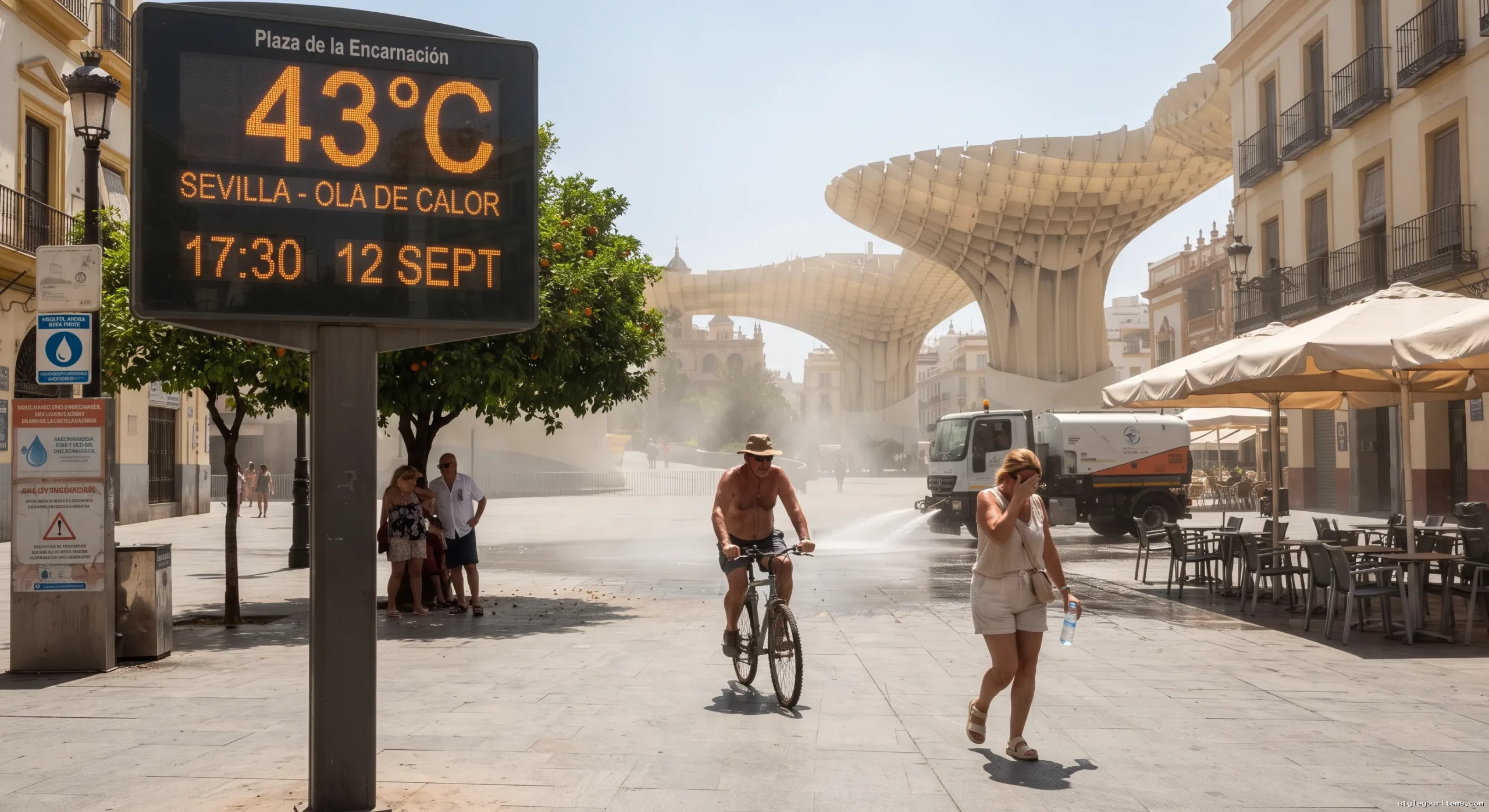
Meteorological autumn has arrived in Spain with conditions more typical of mid-July. A potent, late-season heat dome combined with an influx of North African air is driving thermometers across the Iberian Peninsula toward 43°C, setting up one of the most intense September heat spells in recent years.
The extreme weather is expected to peak between Wednesday and Friday, pushing daytime maximums 4°C to 8°C above seasonal norms across southern, central, and north-eastern regions. Alongside the daytime heat, high nighttime temperatures and widespread Saharan dust will create uncomfortable conditions across large parts of the mainland and the Balearic Islands.
The Meteorological Engine: High Pressure and the African Plume
This unseasonal surge is being driven by two interacting weather patterns:
- A Persistent Upper-Level Ridge: A strong high-pressure system positioned over the Iberian Peninsula is causing the air mass to sink and compress. This process, known as subsidence, traps heat close to the surface and prevents cloud cover from forming, allowing intense solar radiation to bake the ground.
- The Atlantic Cold Pocket: A slow-moving pocket of cooler, low-pressure air parked west of the Portuguese coast is acting as an atmospheric pump. As it rotates counterclockwise, it pulls an expansive tongue of superheated, dry air directly from the Sahara Desert into the interior of Spain.
Forecast models indicate that the 28°C isotherm at 1,500 metres altitude (850 hPa pressure level) will establish itself over central and southern Spain by Friday. At this time of year, such readings at higher atmospheric levels are exceptionally rare and translate directly to extreme ground-level temperatures.
Regional Forecast & Peak Temperatures
| Region / River Basin | Key Cities & Areas Affected | Alert Severity | |
|---|---|---|---|
| Guadalquivir Valley & Andalucia | Sevilla, Córdoba, Jaén, Granada | 41°C – 43°C | High / Orange Alert |
| Extremadura & Central Interior | Badajoz, Cáceres, Toledo, Ciudad Real | 39°C – 41°C | Orange Alert |
| Ebro Basin & North-East | Zaragoza, Lleida | 38°C – 41°C | Orange Alert |
| Northern Pockets (Cantabrian Coast) | Bilbao, interior Basque Country | 39°C – 42°C (Friday peak) | Yellow Alert |
| Balearic & Canary Islands | Mallorca, Ibiza, Gran Canaria | 34°C – 37°C | Yellow Alert |
Andalucia and the Guadalquivir Valley
The Guadalquivir Valley remains the epicentre of this event. Cities such as Córdoba, Sevilla, and Jaén will see daytime highs reach between 41°C and 43°C on Thursday and Friday. Inland areas of Granada will hover close to 40°C.
Extremadura and Central Spain
Across Extremadura (Badajoz and Cáceres) and Castilla-La Mancha (Toledo and Ciudad Real), readings will sit steadily between 39°C and 41°C. Madrid’s southern metropolitan belt will see highs approaching 38°C to 39°C.
The Ebro Valley and Northern Spikes
In north-eastern Spain, the Ebro Valley will funnel the heat into Zaragoza and Lleida, where 40°C is expected. By Friday, southerly winds will carry the warm air mass over the northern mountain ranges, causing a brief temperature surge in the north. Inland parts of the Basque Country, including Bilbao, could see isolated spikes of 40°C to 42°C before a coastal breeze provides relief.
“Torrid” Nights and the Arrival of Saharan Dust (Calima)
The current weather setup presents two additional challenges beyond daytime heat:
Nighttime Temperatures Above 25°CLarge areas of Andalucia, the Mediterranean coast, and the Balearic Islands will experience tropical nights, where the mercury fails to drop below 20°C. In several coastal and urban centres, forecasters warn of torrid nights, with minimum temperatures staying above 25°C. This lack of overnight relief prevents buildings from cooling down and increases heat-related strain.
Suspended Saharan Dust (Calima)Fine mineral dust lifted from North Africa will spread across southern, central, and eastern Spain, as well as the Balearics. While the dust haze may filter sunlight and shave a degree or two off daytime peaks in some localities, it acts as a thermal blanket at night, retaining ground-level heat and lowering air quality.
The Wider Risk: Warm Mediterranean Waters and Autumn Storms
Meteorologists are closely watching a secondary concern: the interaction between prolonged heat and record-high sea surface temperatures.
Parts of the western Mediterranean and Spanish coastal waters registered temperatures between 28°C and 33°C over the summer, including an unprecedented measurement of 28.84°C off Cabo de Gata in Almería.
How Stored Heat Can Fuel Severe Weather:
- Energy Accumulation: Extremely warm coastal waters evaporate moisture rapidly, loading the lower atmosphere with latent heat and water vapour.
- The Atmospheric Trigger: While high pressure keeps conditions stable for now, any incoming Atlantic trough or isolated upper-level cold drop (DANA) will destabilise this volatile air mass.
- Severe Weather Potential: When cold upper air collides with this stored marine energy, it creates prime conditions for intense supercell thunderstorms, torrential flash floods, and localized coastal waterspouts.
Weekend Transition: When Will Temperatures Drop?
The heat dome will begin to weaken over the weekend as an Atlantic trough advances from the west:
- Saturday: Temperatures will begin to ease across western Spain (Galicia, Extremadura, and western Andalucia) as fresher Atlantic air moves inland. However, the eastern half of the country, particularly the Ebro Valley and the Mediterranean coast, will remain very hot.
- Sunday & Early Next Week: As the low-pressure system moves further across the mainland, increased instability will bring a noticeable temperature drop to central and northern areas, along with a rising chance of scattered showers and thunderstorms across the Pyrenees, the Iberian System, and northern mountainous terrain.
Practical Safety and Official Advisories
Spain’s State Meteorological Agency (AEMET) has issued yellow and orange weather alerts for extreme heat across multiple autonomous communities.
- Limit midday exposure: Avoid strenuous outdoor exercise and direct sun exposure between 12:00 PM and 6:00 PM.
- Hydrate regularly: Drink water consistently without waiting until you feel thirsty; limit caffeine and alcohol intake.
- Keep indoor spaces cool: Keep blinds, shutters, and curtains closed on sun-facing windows during the day, opening them only late at night when outdoor temperatures drop below indoor levels.
- Stay updated: Monitor real-time alert updates through official AEMET channels and local emergency services.